Fort Belvoir
Wetland Studies and Solutions, Inc. provided comprehensive natural and cultural resource services and obtained the necessary Clean Water Act permits for the relocation of certain Department of Defense (DOD) agencies during the BRAC initiative at Fort Belvoir.
Project Narrative:
The U.S. Army Garrison at Fort Belvoir was appointed by the Base Realignment and Closure (BRAC) Commission to relocate certain Department of Defense (DOD) agencies to an approximately 628-acre portion of the 807-acre Engineer Proving Ground (EPG). The authorized construction activities resulted in permanent and temporary impacts to 1.34 acres of wetlands, including 2,905 linear feet of streams.
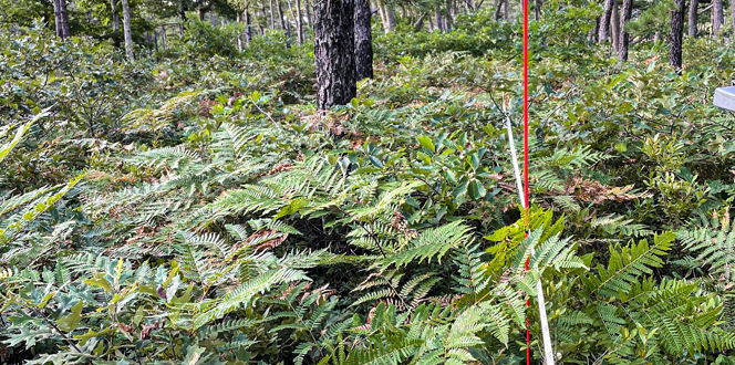
Wetland Studies and Solutions, Inc. (WSSI) was contracted in June 2006 to perform a search for the small whorled pogonia (Isotria medeoloides) for the entire EPG project area; WSSI had previously found the first small whorled pogonia in Fairfax County on a portion of the EPG site proposed for the Fairfax County Parkway. WSSI then delineated and surveyed all Waters of the U.S., including wetlands, on the parcel, completing that in February 2007. WSSI also delineated the Fairfax County Resource Protection Areas (RPA) and Environmental Quality Corridor (EQC) for the site.
Reducing Impacts
WSSI then procured the necessary federal and state wetland and waterway permits for the impacts associated with the project. WSSI initiated pre-application coordination with the U.S. Army Corps of Engineers (COE), the Virginia Department of Environmental Quality (DEQ), and the Virginia Marine Resources Commission (VMRC) in February 2007 in order to bring them into the planning process for the permit, and it was subsequently determined that, in addition to the EPG site property, the wetland permit application needed to incorporate all required off-site improvements as well, such as road, utility, and construction access requirements. WSSI completed the full delineation and survey in July 2007 and then prepared the newly-revised jurisdictional determination forms for the COE, as required by the recent Rapanos decision guidance, to facilitate the COE’s review and issuance of a jurisdictional determination for the entire project, including the off-site areas.
WSSI prepared and submitted the original Joint Permit Application in May 2007. All required individual permits were issued by November 2007, less than one year from the initiation of the wetland delineation and just over six months from the submittal of the permit application. WSSI coordinated and prepared a total of nine permit modifications that ultimately reduced the project's overall impacts by more than 1 acre of wetlands and 3,000 linear feet of stream compared to the original permits. Wetland and stream impact compensation was provided through purchase of credits at WSSI's North Fork Wetlands and Stream Bank and WSSI’s Northern Virginia Stream Restoration Bank. For both projects, WSSI engineers completed the survey of existing conditions, base map preparation, and construction design plans using WSSI’s proprietary design automation system, StreamNCD™, which supports more robust, site-specific designs that are ultimately more cost-effective and successful when constructed. The design plans were then reviewed and approved by all relevant agencies, including the Fort Belvoir Department of Public Works, the U.S. Army Corps of Engineers, the Virginia Department of Environmental Quality, and the Virginia Marine Resources Commission. WSSI provided construction oversight and post-construction monitoring to ensure project success.


